


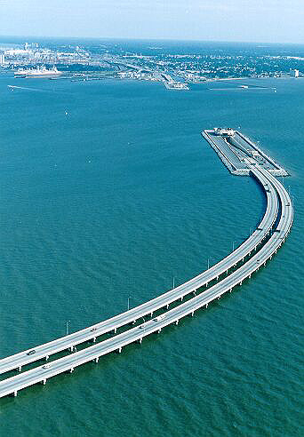
http://www.roadstothefuture.com/I664...BT_Aerial.html
Monitor-Merrimac Memorial Bridge-Tunnel (I-664), looking north.
The curving 3.2-mile-long South Trestle is in the foreground. That connects to the South Island, where the south tunnel portal is, for the 4,800-foot long tunnel. The North Island and Newport News are in the distance. Starting at the left edge of the photo is the Newport News Marine Terminal.
Photo by Virginia Department of Transportation.
Click on photo for larger photo (149K); click on larger photo for even larger photo (227K).
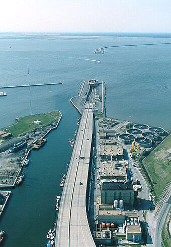
Monitor-Merrimac Memorial Bridge-Tunnel (I-664), looking south from near the tip of Newport News.
In the foreground, you can see the North Approach Bridge, and the Small Boat Harbor to the left. The North Approach Bridge connects to the North Island (actually a peninsula) where the north portal of the tunnel is. In the distance, you can see the South Island and the South Trestle.
Photo by Virginia Department of Transportation.
Click on photo for larger photo (150K); click on larger photo for even larger photo (221K).


 Reply With Quote


Bookmarks